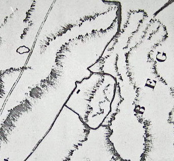
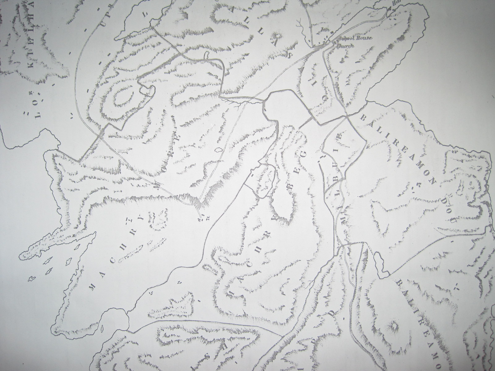
Our illustration is from a later edition of David Wilson’s Colonsay Map of 1804; this particular edition includes the new Mill, so is probably dated about 1870, but the edition is not relevant. We have reproduced a section between Scalasaig and Machrins, and it shows the new road passing An Garbh Cladaich, but does not yet show the one across the Monadh Thomach (which is, presumably, as yet undrained).
A “D” shaped enclosure is shewn to the south of the road and midway between the east and west coasts, on “Machry Beg”, and within that enclosure a building is marked. Can you find any trace of that building? A photograph and accurate GPS reference would be good, together with a description. We offer a £10 Book Token redeemable at Colonsay Bookshop for the best submission, which we hope to publish in the January edition. As far as is known, no previous attempt has been made to locate this site.
You May Also Like...


Recent Posts

The Front Page – July 2018
Though the not-quite-a-drought time eventually ended, summer did not part, as it might have done,...

The Front Page – June 2018
The warm dry spell that spread across the whole country in late spring and extended...

The Front Page – May 2018
Spring came late this year, but by May calving and lambing were well underway on...